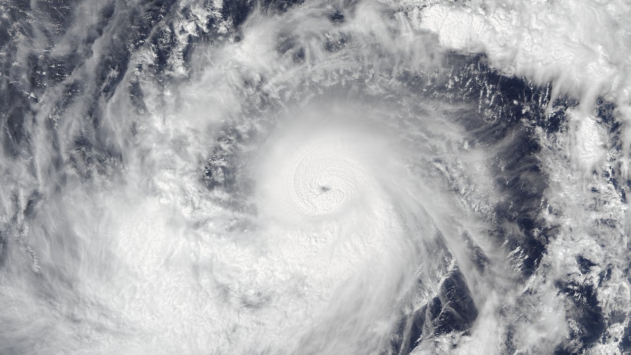
Guam seems to have escaped the worst of Typhoon Champi. The Category 4 storm passed about 10 miles south of Malesso' and 21 miles south of central Guam early Sunday, local time, with 140 mph winds, an NWS meteorologist said on a livestream, according to the Pacific Daily News, which reports that the eyewall did not graze the island as forecasters had expected. The National Weather Service (NWS) office in Tiyan, Guam, says Champi looks set to move away from Guam coastal waters through Monday.
In Intermediate Advisory Number 13A, issued at 5:14 AM ChST Sunday, Oct. 18 (12:14 PM PT Saturday), the NWS states that the center made its closest point of approach around 4:26 AM ChST, “very near to the southern point of Guam.” At 5:00 AM ChST (noon PT Saturday), the advisory places Champi near 13.0N 144.6E, about 35 miles south-southwest of Guam and 90 miles south-southwest of Rota, moving west at 14 mph with maximum sustained winds of 140 mph. It says Champi looks set to turn slightly west-northwest and move away from Guam coastal waters through Monday, and that it forecasts the storm to hold that intensity through Sunday night.
Three and a half hours earlier, NWS Advisory Number 13 (1:57 AM ChST) still put the center about 55 miles southeast of Guam at 1:00 AM ChST, with winds already at 140 mph, and said the track would bring Champi “very close to Guam over the next few hours.” That advisory also said Champi could still become a super typhoon as it intensified through Monday. By Intermediate Advisory 13A, the typhoon-force wind field had narrowed from 60 miles out from the center to 25 miles, while tropical-storm-force winds still reached up to 125 miles. A Typhoon Warning remained in effect for Guam, Rota and the adjacent waters; a Tropical Storm Warning and a Typhoon Watch remained for Tinian and Saipan.
Local reporting fills in the miss. The Pacific Daily News, in a running update last headed 5:43 AM ChST Sunday (“Champi just misses Guam, leaves ‘as fast as it arrived’”), quotes Landon Aydlett, an NWS warning coordinator meteorologist speaking on an NWS Facebook livestream, as saying Champi made a “near miss” just south of Malesso' by 10 miles and 21 miles south of central Guam. Aydlett said Champi continued west at 14 mph and would “clear out of the area as fast as it arrived,” the paper reports, and that remaining strong tropical-storm and low-end Category 1 typhoon-force winds would stay limited to far southern Guam, with weaker winds across central and northern Guam. He said tropical-storm-force conditions could ease as early as late Sunday afternoon if Champi clears sooner. The paper quotes him: “This is good news for us. It was looking grim for us, but strong gusts kept those major winds way [sic] from us. Be thankful we dodged a major strike with this event.” Aydlett also called the pass an “easy pass” for Saipan and Tinian and said the NWS had discontinued flash flood watches for both, according to the paper.
An earlier Pacific Daily News entry, headed 5:12 AM ChST, reports Champi about 30 miles south of Guam and moving at 15 mph, says the NWS reported the storm already due west and past Guam, and states: “The eyewall turned out to not graze the island as anticipated.” That entry notes a Joint Information Center release just before 5:00 AM ChST that still put closest approach within the next hour or two and warned that typhoon-force winds would continue after closest approach; the JIC, as quoted by the paper, said the far southern tip should brace for destructive winds of 110 to 135 mph, with potential significant to catastrophic damage especially to non-concrete structures, and that peak conditions would run through late morning. Distance figures differ slightly among products: NWS Intermediate Advisory 13A gives about 35 miles south-southwest at 5:00 AM ChST; the 5:12 AM Pacific Daily News entry gives about 30 miles south; Aydlett’s livestream figures, as the paper reports them, put the pass 10 miles south of Malesso' and 21 miles south of central Guam. This desk flags those gaps without resolving them.
Extreme winds still posed a threat at the time of closest approach. The Pacific Daily News, in a 4:12 AM ChST entry, reports an extreme wind warning from 3:52 AM ChST for southern villages Talo'fo'fo', Inalåhan, Malesso', Sånta Rita-Sumai and Humåtak until 5:30 AM ChST. Citing the NWS, the paper says Andersen Air Force Base Doppler radar showed extreme winds associated with Champi’s northern eyewall moving onshore westward at 15 mph, and that residents should prepare for destructive winds of 115 to 135 mph across the far south, “producing swaths of significant to catastrophic damage.” The paper quotes the NWS: “Take cover now! The safest place to be during a major typhoon passage is in a reinforced interior room away from windows. If you are not in a fully concrete structure, get under a table or other piece of sturdy furniture. Use mattresses, blankets or pillows to cover your head and body.”
The NWS’s most recent local statement this desk retrieved, updated at 4:40 AM ChST Sunday (before Intermediate Advisory 13A), still described Champi as a Category 4 moving into Guam coastal waters, with the center then about 25 miles southeast of Guam at 4:00 AM ChST, intensity 140 mph, and a forecast track about 15 miles south of Guam. It said a Flash Flood Warning covered Guam, warned that “Devastating damage will occur,” and forecast maximum winds of 100 to 120 mph with gusts to 145 mph far to the south and 60 to 70 mph with gusts to 85 mph over northern Guam. It also warned of breaking waves of 30 to 35 feet along east-to-south reefs, coastal inundation of upwards of 5 to 7 feet along eastern and southern exposures, and 8 to 14 inches of rain. That statement predates the post-pass livestream wording Aydlett gave the Pacific Daily News.
The Joint Typhoon Warning Center (JTWC) in Pearl Harbor, in Warning Number 13 (issued 1:00 AM ChST Sunday, or 8:00 AM PT Saturday, with a warning position for 10:00 PM ChST Saturday), still placed Champi near 12.6N 146.1E—east-southeast of Guam—with maximum sustained one-minute winds of 120 knots gusting to 145 (about 138 mph gusting to 167 mph, by this desk’s conversion) at that earlier hour. It forecast 120 knots at 10:00 AM ChST Sunday (5:00 PM PT Saturday) near 13.0N 143.7E and a later peak of 140 knots gusting to 170. That product predates closest approach and the NWS’s 140 mph post-pass figure; this desk treats it as the latest JTWC bulletin available at write time, not as a post-pass damage report.
Power restoration planning already sits in public view. The Guam Daily Post (John O'Connor), citing a Guam Power Authority release dated Oct. 17, reports that GPA’s critical restoration priorities after Champi include hospitals, critical healthcare centers, critical communications infrastructure, Guam Homeland Security and the Office of Civil Defense, Guam Fire Department 911 services, water wells and wastewater facilities, critical infrastructure facilities and ports of entry. The utility said it would mobilize assessments and repairs “immediately after the typhoon passes and high winds subside to a safe level,” that it does not intend to shut down the islandwide system on purpose, and that circuits or feeders can shut off automatically when they take damage. The Post quotes the release: “Updates on power restoration will be provided to media, Office of Homeland Security/Office of Civil Defense, and posted on GPA’s social media pages and website.” The release also directs nonemergency reports to the Customer Call Center and emergency reports—downed energized lines, broken poles or blown transformers—to GPA’s 24-hour trouble dispatch, the paper reports.
No source this desk read published a confirmed islandwide injury count, death toll or finished damage survey by the time of writing; the Pacific Daily News and NWS products describe expected and ongoing wind and flood hazards, and the GPA release sets out a restoration process rather than measured outages. Reading note: this desk wrote from NWS Intermediate Advisory 13A, Advisory Number 13 and the 4:40 AM ChST local statement, JTWC Warning Number 13, Pacific Daily News updates through 5:43 AM ChST, and the Guam Daily Post’s GPA release story—not field reporting. Residents should follow the NWS in Tiyan, Guam Homeland Security / Office of Civil Defense and GPA, not this summary. This desk’s previous Champi story covered the Category 4 upgrade hours before closest approach.
